
Solar Potential Maps
Solar cadastres are interactive maps that show for each building in a city how suitable it is for generating solar energy. Such cadastres benefit everyone: They serve as a generally understandable orientation aid and have an impetus for the expansion of solar energy use among owners.
Product features
Interactive map
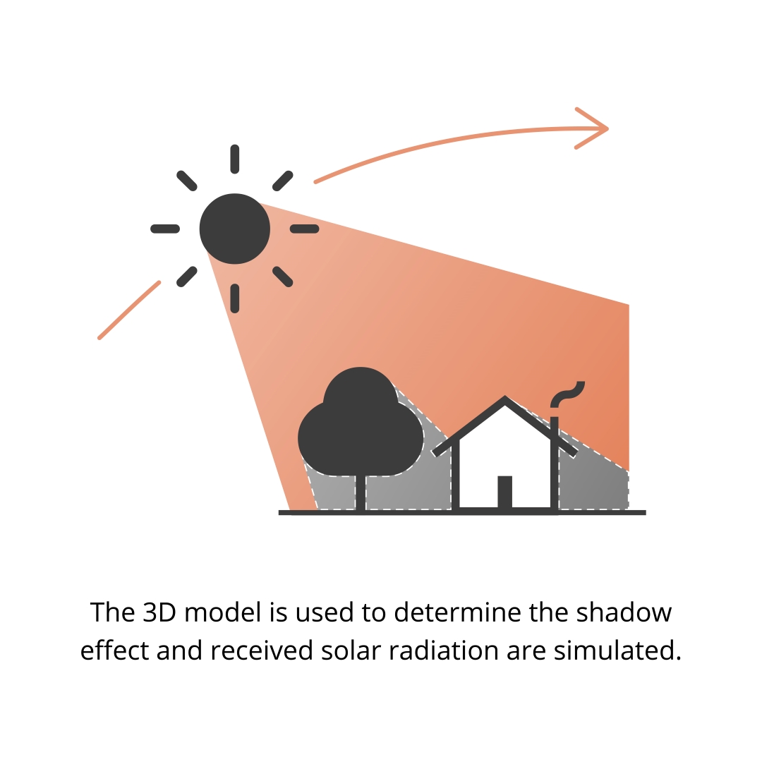
Illustration of the suitability of buildings for the use of solar energy in an urban area.
The suitability of the roof area for photovoltaics and solar thermal energy is shown in different colours for each suitability level
The usable solar irradiation on the roof surfaces is displayed
Detailed representation of the roof sections suitable for the installation of the systems
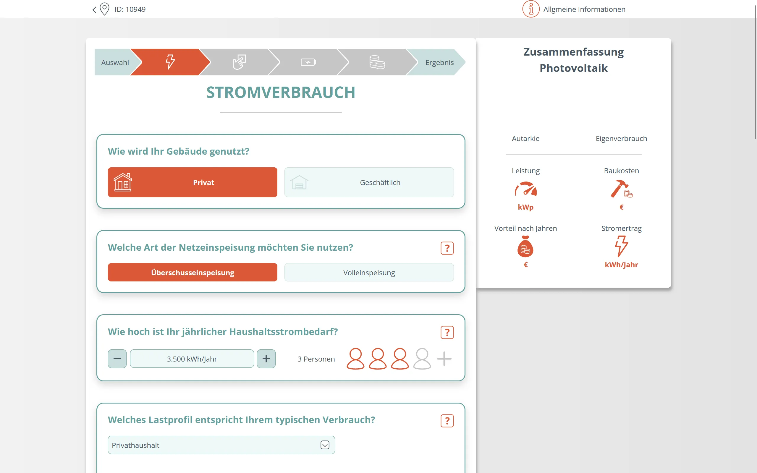
Assistant for planning the solar plant
Intuitive user guidance - for individual configuration of a solar system
Creation of an individual overview in PDF format for optimal use of the roof
Extensive prior knowledge not necessary: Use of average values possible
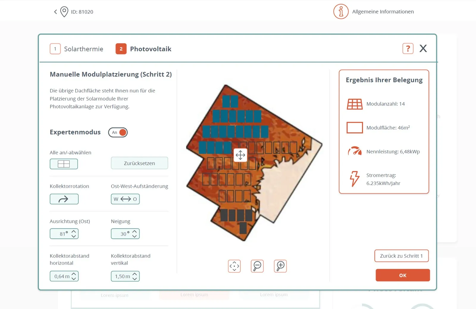
Module placer
Modules can be placed on a roof surface and the system can thus be adapted to own needs and requirements
Individual adjustment of the size dimensions and performance parameters as well as alignment of the planned system
Good basis for detailed advice from craftsmen
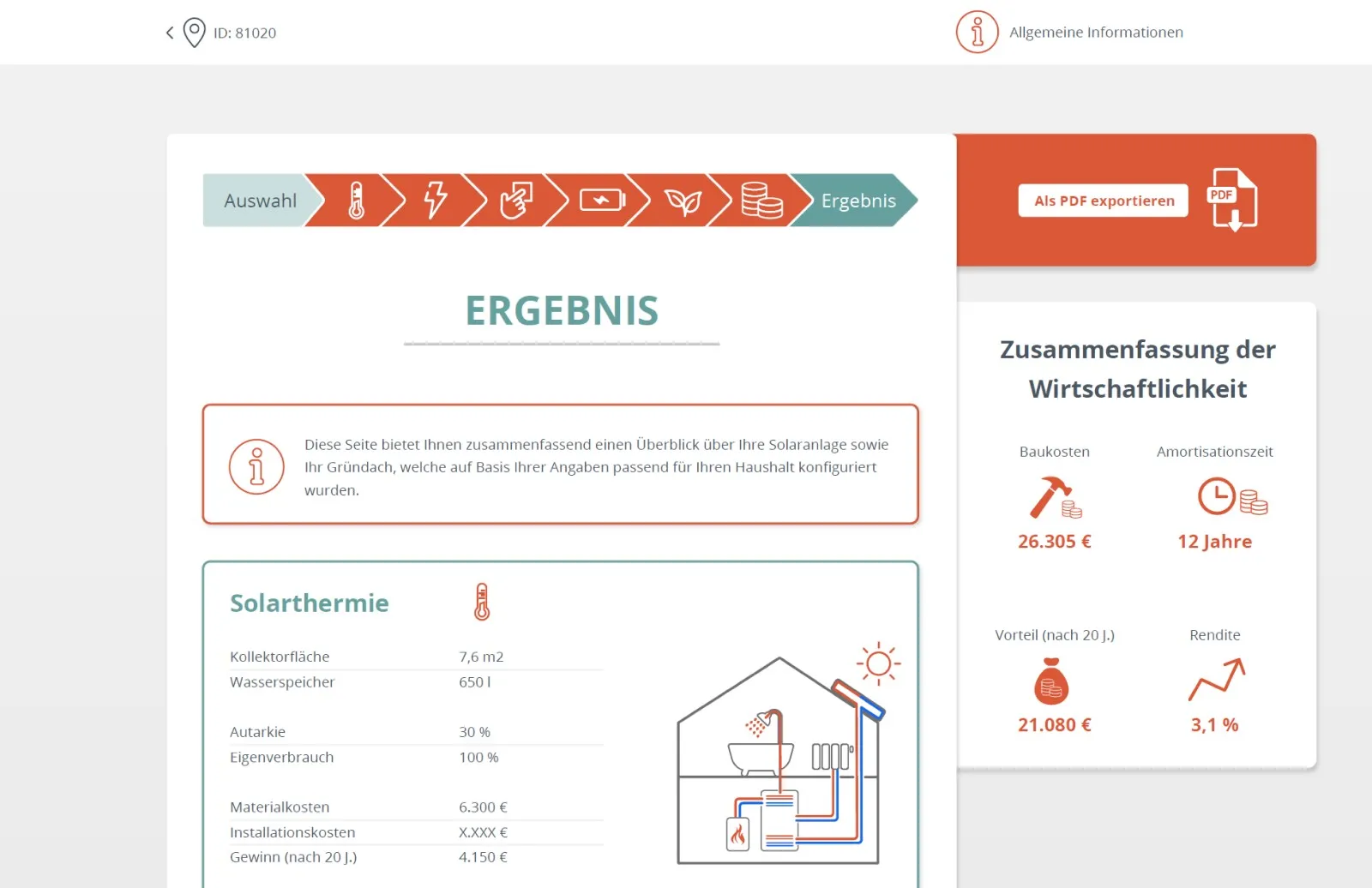
Profitability calculator
Detailed statements on the economic efficiency of the plant
Calculation of independence, amortisation and return on investment
Accurate results due to the inclusion of essential calculation parameters
Continuous adjustment of the framework conditions (electricity price, changed remuneration rates)
The technology
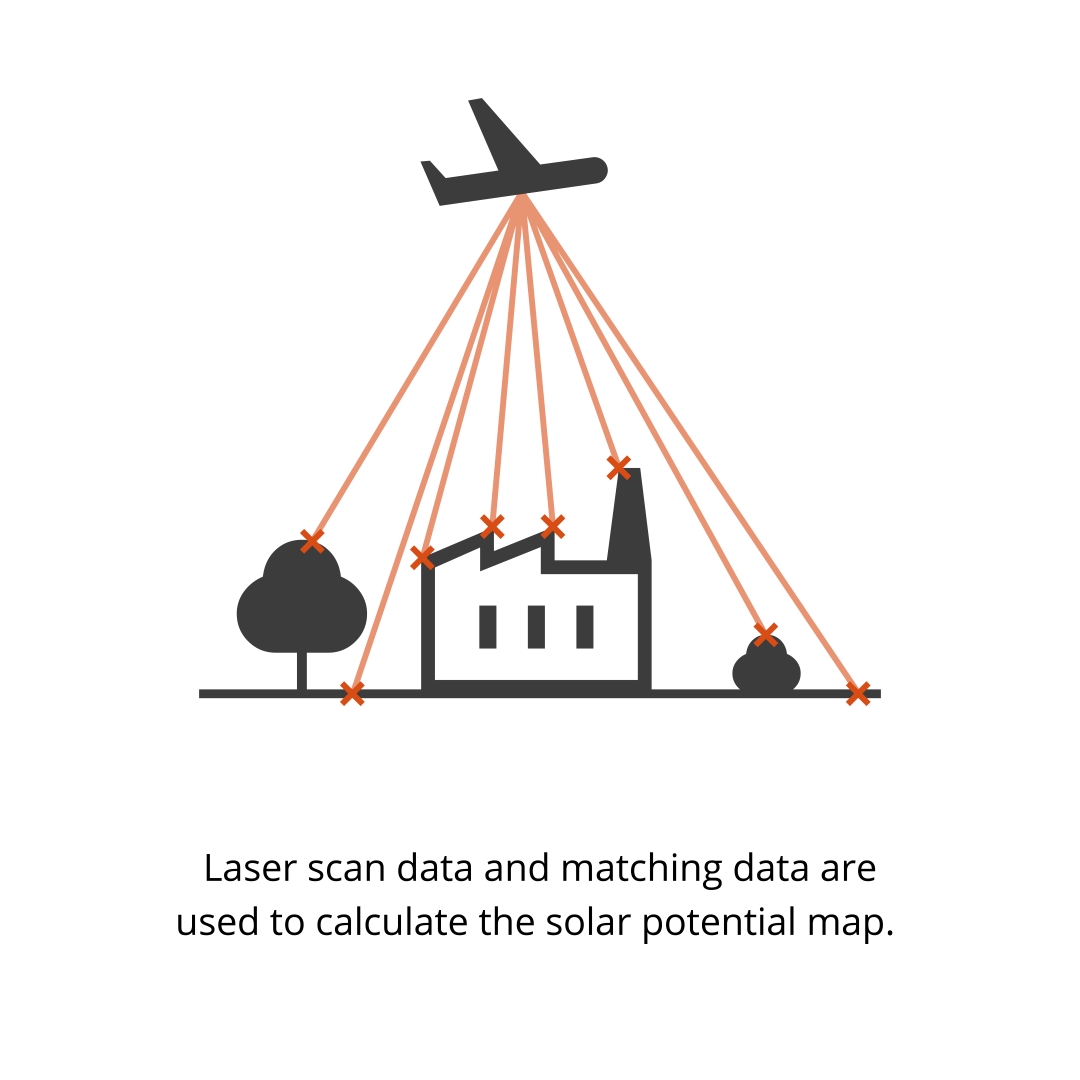
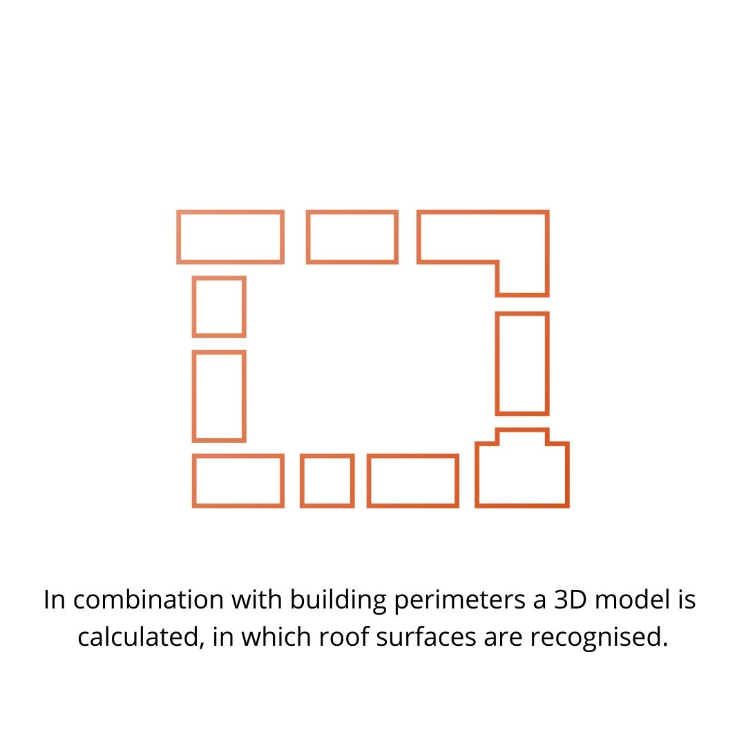
Solar Potential Maps are based on three-dimensional surface models. Common elevation data from laser scanning or aerial photography data can be automatically converted into a 3D model using software developed by tetraeder.solar specifically for this purpose, where it can be further processed together with the data from the real estate maps (ALK/ALKIS). Depending on the federal state, the laser scan data can be used free of charge or for a small fee.
Advantages


Product selection

The interactive map application enables the representation of the suitability of buildings for the use of green roofs in a municipality.

Detection of potential open spaces for photovoltaic parks. Takes into account economic, regional planning and individual aspects and enables contact and negotiations with owners and municipalities.

The craftsmen's portal brings interested citizens and local craftsmen's businesses together by making the range of services and contact details available for viewing.
The solar roof exchange is interesting for those who do not want to buy their own system. House owners have the opportunity to offer their roof for lease to interested parties who would like to operate a PV system.
The offer includes on-site and online lectures, the creation of flyers and information brochures.
